Washington D.C. Map Print Review — Minimalist Neighborhood Map by Native Maps
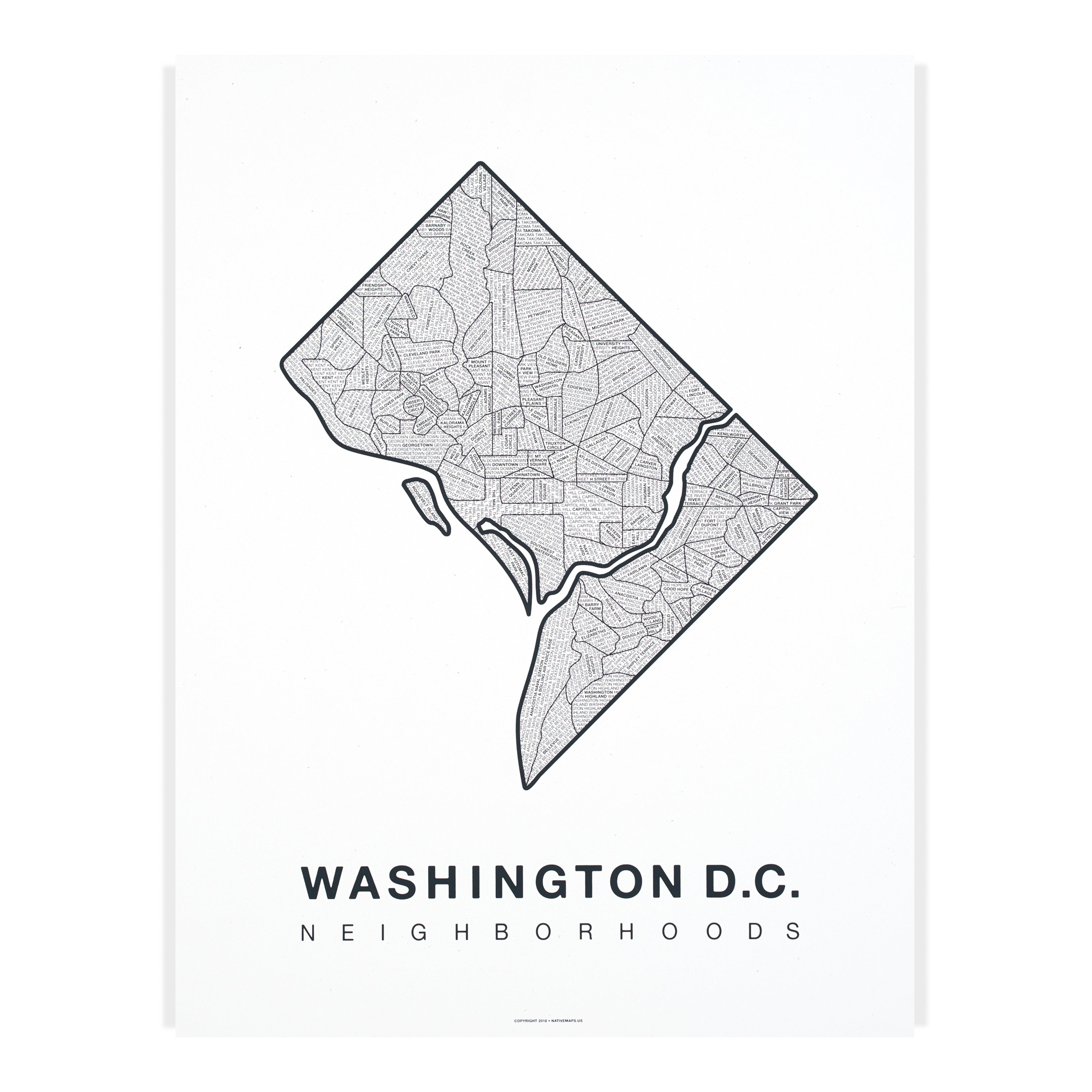
Looking for a piece of wall art that captures hometown pride without shouting for attention? The Washington D.C. map print from Native Maps aims to do exactly that: a hand-printed, neighborhood-vetted, minimalist map that works as thoughtful decor or a meaningful gift. In this review I break down what the map looks like, how it’s made, the options available, and whether it deserves a spot on your wall.
Quick overview — what this product is
The Washington D.C. map print is a hand-printed city map poster that highlights every neighborhood within the D.C. city boundary in a clean, minimalist design. It’s offered in multiple colorways (Grey-Blue on Speckle White, White on Navy, White on Charcoal, Grey-Blue on Kraft, Cream on Coral, Teal on Navy), two standard sizes (16″ x 20″ and 18″ x 24″), and several finish options: print-only, framed (walnut, oak, whitewash), or wall hanger options.
Who makes it
Native Maps designs and prints this product. The design is vetted by locals to ensure neighborhood accuracy and thoughtful composition — a detail that matters if you want a map that’s both decorative and recognizable.
Key features and real-world benefits
- Hand-printed, local-vetted map: The map is produced with a hands-on printing process and reviewed by a team of locals. Benefit: the layout and neighborhood labels feel authentic rather than generic.
- Multiple colorways: Several curated color combinations let you match the map to your room’s palette — neutrals for subtlety or bolder contrasts for statement pieces.
- Frame and hanger options: Choose plain print-only, a framed print (walnut, oak, whitewash) or a minimalist wood hanger. Benefit: saves you a trip to the framer; the finished piece arrives ready to hang.
- Two handy sizes: 16″ x 20″ and 18″ x 24″ fit common frames and wall spaces, from gallery walls to small entryways.
- High visual clarity: Minimalist linework keeps the map legible at a glance — good for both decor and wayfinding nostalgia.
- Giftable packaging: Images show secure packaging including a shipping tube and careful backing (ideal for gifting or safe transit).
Price and options (what to expect)
Prices vary by finish:
| Print only | $40 — $45 (depending on size) |
| Print + Wood Hanger | $100 — $105 |
| Print + Frame (Walnut / Oak / White) | ≈ $175 (framed) |
Those price points make the map accessible as an entry-level art purchase (print-only) while still offering a premium, ready-to-hang option if you want a turnkey piece.
Design details — why the map stands out
The map’s visual identity is built around restraint. Streets, parks, and neighborhood blocks are rendered in a minimalist, grid-friendly style that reads well from a distance and holds up close. The team’s vetting of neighborhood boundaries adds credibility — important if you want the map to reflect a real connection to D.C. rather than an abstract motif.
Color choices are smartly chosen to suit interior styles:
- Muted speckle white and kraft for warm, organic rooms.
- High-contrast navy or charcoal for contemporary spaces.
- Playful coral or teal options for accent walls or modern offices.
Material quality and finish
Images and product data indicate archival-style paper and careful framing options (oak and walnut frames, whitewash finish). The framed variants are significantly heavier and ship with protective framing backs. If longevity matters, opt for the framed version or get the print mounted with archival framing materials.
Installation and placement ideas
The map works in many spots:
- Above a living room loveseat or entry console (18″ x 24″ framed).
- Grouped in a gallery wall alongside photos and smaller prints (16″ x 20″ aligns well).
- In a home office or study for a subtle connection to place and memory.
- As a gift for a friend who loves D.C. neighborhoods or is relocating.
“A minimalist map that balances accurate neighborhood detail with interior-friendly design.”
Pros and cons — concise summary
- Pros: Local-vetted accuracy, multiple colorways, ready-to-hang framing options, affordable print-only price, strong visual clarity.
- Cons: Framed options are pricey (but include frame); some white-framed colors may be limited in availability; the design is intentionally minimalist, so it’s not for someone who wants a highly detailed geographical map.
Who should buy this Washington D.C. map print?
Recommended for:
- Residents and ex-residents who want a tasteful reminder of their neighborhood.
- Homeowners and renters seeking understated wall art with local meaning.
- Gift buyers looking for a personal, design-forward present for D.C. lovers.
- People who value ready-to-hang options and curated color choices.
Not recommended for:
- Buyers who need highly detailed transit maps or full cartographic overlays (this is decorative, not a technical map).
- Those who prefer very large-scale, statement murals — the available sizes are modest and frame-forward.
Final verdict
The Washington D.C. map print from Native Maps is a strong option if you want minimalist, locally vetted map art that integrates easily into modern interiors. The print-only option offers an affordable way to add meaning to a space, while framed or hanger versions give you a polished, ready-to-display piece. If you want a decorative map that celebrates neighborhoods rather than deliver exhaustive geographic detail, this product is a smart buy.
Bottom line: Buy this map if you value authentic, neighborhood-focused wall art with clean design and flexible finish options. Skip it if you need a technical or large-scale map for reference.
Note: Prices and frame availability vary by color and size. Options pictured include framed, hanger, and print-only presentations.
Get code here 10% OFF: Native Maps